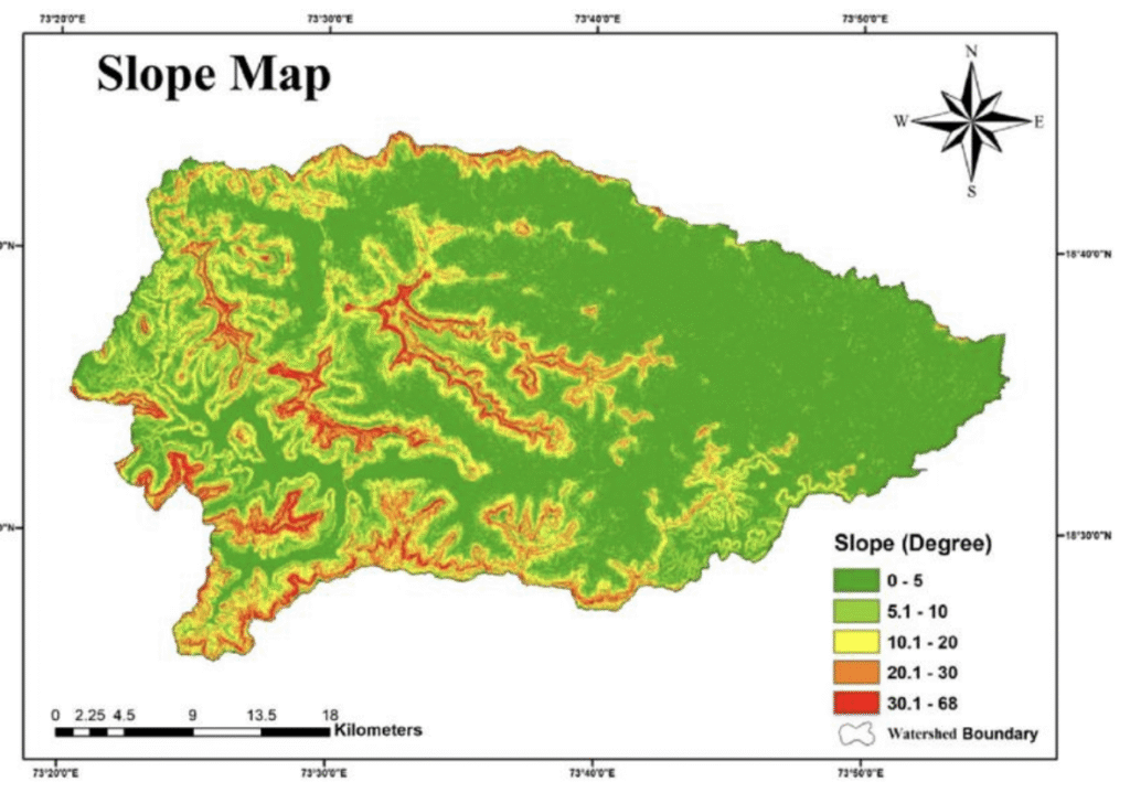
Remote sensing is the process of collecting data about the Earth from a distance using sensors on satellites or aircraft, while Geographic Information Systems (GIS) is a computer system that captures, stores, analyzes, and displays this and other spatial data to create maps and aid in decision-making. The two technologies work together, with remote sensing providing the data (like satellite imagery) that is then analyzed and visualized within a GIS.